At 7.34 on the morning of Monday 10 August, a magnitude 7.4 earthquake struck western Colombia, with its epicentre near the town of San José del Palmar in the department of Chocó. It was the most destructive earthquake the country has experienced in more than a generation. The official count on the evening of 18 August stood at 312 dead, 4,611 injured, and 290 still missing, with 358 people pulled out alive. The missing figure is now falling rather than rising, down from more than four hundred earlier the same day, as bodies are identified and people are traced. Close to thirty thousand homes have been destroyed and more than 134,000 damaged, and around 294,000 people across fifteen departments are counted as affected. The government has declared a national disaster and three days of national mourning, and followed it on 12 August with a declaration of economic emergency.
We write about Colombia often on this blog, and almost always in the register of a country worth taking slowly. This piece is a different kind of post. Anyone with a trip booked, or a trip half-planned, deserves a clear account of what has happened and what it does and does not mean for travelling here. That is what follows, current as of 19 August. Before any of it, though, the plain fact is that a great many Colombian families are burying people this week, and no amount of practical travel advice should be read past that.
Why an Earthquake in Chocó Was Felt in Bogotá
One detail explains most of what people found confusing in the first hours: the earthquake was unusually deep, roughly 110 kilometres down, within the Nazca plate as it descends beneath South America. Depth changes the character of a quake considerably. A shallow earthquake concentrates violent shaking into a small area; a deep one spreads weaker shaking across a very large one.
That is why something in the order of ten and a half million people felt strong or very strong shaking, why apartments in Bogotá emptied into the streets, and why the first reports out of the capital sounded far worse than the damage turned out to be. Bogotá logged several hundred reports of cracks and fissures, but essentially nothing structural. The destruction was concentrated hundreds of kilometres to the west, in the mountains where the shaking met older and more vulnerable buildings. More than three hundred aftershocks have followed, twenty-one of them above magnitude 3.0 and two above magnitude 4.0, though the largest of the whole sequence remains the magnitude 5.0 that came within the first hour.
Which Parts of the Country Are Affected
The damage is concentrated in five departments: Chocó, where the epicentre lay, and Risaralda, Quindío, Caldas, and Valle del Cauca to its east and south. In practical terms that means the Eje Cafetero, Colombia’s coffee-growing heartland, together with Cali and the Pacific coast around Buenaventura.
Pereira has suffered the heaviest loss of life of any city, with more than a hundred dead, followed closely by Cali. Manizales, Armenia, and Quibdó have all taken serious damage. The night-time curfew in Pereira was lifted on 17 August, which is the clearest sign so far that the emergency phase there is easing. Beyond the buildings, the infrastructure toll is severe and will take much longer to put right: 432 roads damaged, forty-four bridges affected, 335 health centres and more than three thousand schools hit, and some twenty rockslides on the Cali to Buenaventura highway, the artery connecting the coffee region to its main export port. Traffic is moving on that road again, slowly, as the debris is cleared. The government’s preliminary estimate of the damage is 30 trillion pesos, around 9.6 billion US dollars, and modelling by the United States Geological Survey puts the eventual figure considerably higher.
It is worth being equally clear about where the damage is not. Bogotá, Cartagena, and the Caribbean coast are not part of this. Medellín, on the northern edge of the shaking, saw scattered damage in outlying areas and put several hundred firefighters and engineers through a round of building inspections, which is a sensible precaution rather than a sign of a damaged city.
Flying Into and Around Colombia
The aviation picture moved a great deal in the first week and has largely settled since. Several airports closed on the day of the quake for structural inspection. Most have since reopened, some at reduced capacity, and three are still shut. The position as of 19 August:
| Airport | City | Status |
|---|---|---|
| El Dorado (BOG) | Bogotá | Operating normally throughout |
| Rafael Núñez (CTG) | Cartagena | Operating normally throughout |
| José María Córdova (MDE) | Medellín | Open to commercial flights |
| Alfonso Bonilla Aragón (CLO) | Cali | Open, no damage to infrastructure |
| El Caraño (UIB) | Quibdó | Open, limited capacity |
| El Edén (AXM) | Armenia | Open, limited capacity, extra flights added |
| La Nubia (MZL) | Manizales | Open, restricted operations, control tower under repair |
| Gerardo Tovar López (BUN) | Buenaventura | Open, restricted operations |
| Guillermo León Valencia (PPN) | Popayán | Closed, volcanic ash from Puracé |
| Matecaña (PEI) | Pereira | Closed to commercial flights, repairs under way |
| Santa Ana (CRC) | Cartago | State, emergency, and humanitarian flights only |
Pereira is the airport that matters most, and it is the one with the clearest news this week. Matecaña was the worst hit of them all: three people died there on the morning of the quake, and the four-storey passenger building was badly damaged, the second floor worst of all. The runway and the control tower came through intact, which is why the airport has been able to handle medical, search and rescue, state, and humanitarian flights throughout. Around two hundred workers have cleared the debris and are now rebuilding damaged masonry. The date discussed publicly has been a commercial reopening around 22 August, but the civil aviation authority’s own update on 18 August named no date at all, reporting only that the works are progressing well. When Matecaña does reopen it will do so with a restricted terminal, since the lifts and escalators were damaged and will not be running in the first phase.
Until then, Armenia and Cali are absorbing the traffic, and the carriers have extended their protections rather than let them lapse. Avianca’s cover now runs to 30 August for flights touching Pereira, Cali, Armenia, and Quibdó, with rebooking permitted as late as 30 September. LATAM is allowing free date changes, refunds, and route changes on tickets for travel up to 23 August, and has added flights on the Bogotá to Armenia and Bogotá to Cali routes to soak up the demand that would otherwise have gone through Pereira. LATAM’s window closes on 23 August, so anyone still holding an affected ticket would do better to act on it this week than to wait and see whether Pereira reopens.
Popayán is the one closure that has nothing to do with earthquake damage. The quake appears to have disturbed the Puracé volcano, twenty-seven kilometres from the city and already at orange alert since 1 August, which has been sending ash columns a few hundred metres above its crater. Ash and aircraft do not mix, so Guillermo León Valencia has been shut as a precaution. Popayán does not feature in our journeys, but it is worth knowing about for anyone routing through southern Colombia independently.
Two caveats still matter. Manizales, Armenia, and Buenaventura are all flying under restricted conditions rather than normally, with repairs to the Manizales control tower still under way after the quake left it with fissures and broken glass. And several of these airports swung between open and closed within a single day while inspections were under way. Anyone holding a ticket into the region should confirm directly with their airline on the day rather than relying on any published list, this one included.
What This Means for Our Colombia Journeys
We can be straightforward here, because the geography answers the question. The Colombian journeys we arrange are built around three cities: Bogotá, Cartagena, and Medellín. None of them is in the affected region, and none of the tours we run passes through Chocó, the Eje Cafetero, or Valle del Cauca.
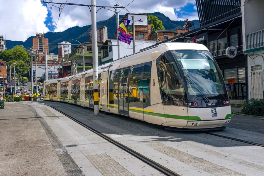
That is not a reassurance we have constructed after the fact. It is simply how our Colombia itineraries have always been shaped, around three hubs connected by short domestic flights. The salt cathedral at Zipaquirá, the walled city of Cartagena, Guatapé and El Peñol, the Metrocable, and the coffee farms in the hills of Antioquia outside Medellín are all well clear of the damage. Colombia’s coffee country is larger than the Eje Cafetero, and the Antioquian farms our coffee morning visits are a different region altogether from the one in the news.
Travellers currently in or heading to the coffee region are a different matter, and the team we work with on the ground is actively managing that: rerouting by land where flights are not running, and adjusting itineraries towards airports that are operating. If you are in that position, or you have a booking that touches the region, write to us and we will sort it out with them directly.
Should You Cancel?
If your trip goes to Bogotá, Cartagena, or Medellín, there is no safety reason to cancel, and we would not pretend otherwise in either direction. If your trip is built around the coffee region in the next few weeks, the honest answer is that it should probably be moved or reshaped, and we would rather say so than watch someone arrive into a town that is still counting its dead.
There is a further point that is easy to make badly, so we will make it plainly. Tourism is a significant part of the Colombian economy, and the instinct to stay away from an entire country because part of it has been damaged does real harm to people who have already lost a great deal. Cartagena’s hotels and Bogotá’s guides do not benefit from empty months. Going, when going is sensible, is a more useful response than cancelling out of a general unease.
What we would ask is that anyone travelling to Colombia in the coming months does so with some awareness of what the country has just been through. The recovery in Chocó and the Eje Cafetero will be measured in years, not weeks. We will update this post as the situation develops, and anyone with a booked or planned trip who wants to talk it through should simply get in touch.
Last updated on 19 August 2026. The airport picture in particular changes from day to day, so please confirm with your airline before you travel.

Written by
Mano Chandra Dhas ›Founder of Coromandel Tours. In travel since 1975, from Singapore Airlines to Emirates and Carlson Wagonlit, he now curates private journeys through Colombia, Peru, India, and Nepal from his home in Bogotá. Many of the photographs on this site are his.