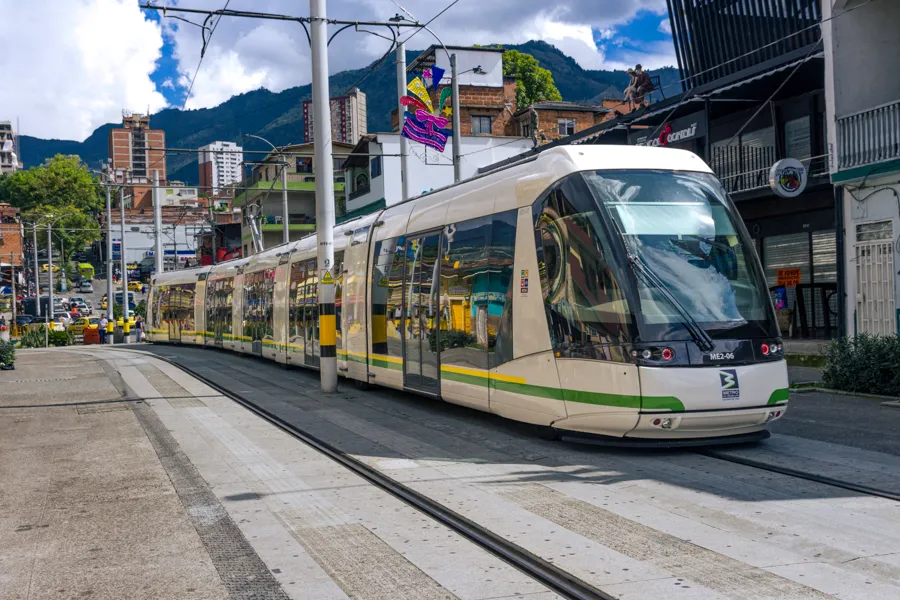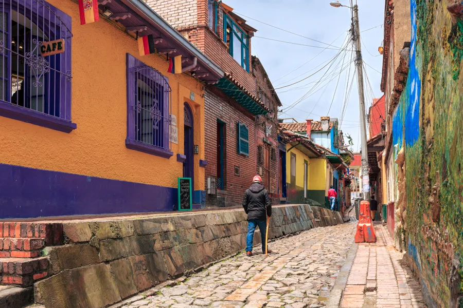
Guatavita - one of my favourite towns. It is not far away from Bogotá. I would recommend the route through Sesquilé. The distance from Bogotá to Sesquilé is 36 miles and from Sesquilé to the New Guatavita town, 13 miles. If you drive straight through, it will take you a little over an hour and 30 minutes. I would however recommend a short stop at Sesquilé.
 An Arch Gateway To One Of The Main Town Squares
You may find the names of several towns in Colombia very different from what you’d have encountered in other parts of the world. That is actually one good thing the Spanish colonialists did: they retained the original indigenous names of various towns and cities across the Country. You, therefore, have interesting names like Guatavita, Sesquilé, Tocancipá, Gachancipá, Zipaquirá etc. The towns and cities are as interesting as the sound of their names (we need to pay special attention to the accent over vowels when learning to say the names).
When you think of a tourist’s trip to Guatavita, there are two lakes involved. You will need to clearly indicate to your driver or tour company, which one you wish to visit. One is the ancient, sacred Laguna Guatavita and the other, is the Embalse de Tominé or Tominé Reservoir. In my personal opinion, you cannot do justice to both the lakes in a single day if you wish to spend time in Guatavita town. You may wish to stay the night in Guatavita if you want to visit both lakes.
How to get there – drive to Guatavita
 Sesquilé - The Main Town Square
The easiest way to get there is by car, taxi or a public bus. Unless you are used to driving in Colombia, I would recommend that you do not drive yourself. The popular way to get there is to hire a car and driver. Please negotiate your fare before you leave the Capital city and ensure that you ask to be brought back as well. As mentioned earlier, I would recommend that you access Guatavita through the town of Sesquilé.
A Note About Sesquilé and the Muisca
It is estimated they were once between 500,000 and 3 Million Muisca people (there is no accurate figure available), during the time of the Spanish invasion. In 2005 there was a study of Colombia’s Muisca people and the total remaining Muisca population in Colombia. There were a little over 14,000. Today they are found in certain areas as small communities in the Department of Cundinamarca and Bogotá DC. The Muisca Councils of Cota, Chía and Sesquilé together in 2006 numbered only 2,318 people.
You may not normally see any of them when you visit Sesquilé. If you are lucky, you may get to see a few of them selling their handicraft or souvenirs, in a corner of the main square.
They do not seem to like being photographed. Please ask them for permission before you click your shutter. On one of my visits to the town, I was lucky to see a couple of them. They however would not allow me to photograph either them or their wares. Well, I was lucky to see some Muisca people.
The Altiplano Cundiboyacense
As you drive to Sesquilé, you will get an idea of the flatness of the high-altitude Altiplano – basically, a high plateau. It was part of the long inland sea of northern South America, formed as a part of the uplift of the Eastern Ranges of the Colombian Andes since Neogene times.
The drive will also give you an idea of why Bogotá is one of the largest cities in South America. The city can expand almost endlessly. You will see mountains by the side and lush green vegetation in the Sabana de Bogotá all along the way. Keep your fingers crossed for no rain on the day of your drive. Remember Colombia is the rainiest country in the world!
In Sesquilé you can get down, stretch your legs a bit and walk around the main plaza or visit the church and the chapel (if they are open). After you have done that and have had a delicious cup of Colombian coffee and a Pastel de Pollo in the rustic Panadería (bakery), on the square (as you stand on the square facing the church, you will find the Panadería on the right), you will be driven to Guatavita.
The Spanish Conquistadors and Laguna Guatavita
The Sacred Laguna de Guatavita
The Spanish Conquistadors had learnt about Laguna Guatavita probably even as early as 1531 CE. You will remember that the Spaniards actually came to this part of the world, looking for the precious yellow metal.
If we go back into history a bit, before the Spanish arrived on the scene, the area was inhabited by the Muisca tribe and ruled by the Casique (Ruler), of Guatavita. He was a powerful figure and consulted regularly by the Zipas of Bacatá (Bogotá) and the Zaques of Hunza. Guatavita specialised in working with gold.
The Legend of El Dorado
The Laguna Guatavita was high on the Colonialists’ list in their quest for gold. They had heard that to the local indigenous Muisca Tribe, the lake was sacred. On the appointment of a new Casique, as part of the ceremony, he was covered in gold dust (for that reason named El Dorado - the golden one - by the Spanish) and was ferried on a ceremonial raft towards the centre of the lake.
He jumped into the water to wash off the gold. Attendants and followers then offered gold artefacts and objects, emeralds and jewellery to the gods of Laguna Guatavita. Much of what survived that era is now in the Museo del Oro in the capital, which the city tour of Bogotá takes in.
The Spanish tried to drain the lake in an attempt to find the gold. They initially managed to lower the surface level by about 10 feet before abandoning the project. It is said that later another person tried to drain the water by cutting a notch deep into the rim of the lake. He succeeded in lowering the level a bit more. Little did they know that the depth of the lake is 410 feet. The Spaniards’ attempts at draining the natural lake were a futile exercise. Laguna Guatavita keeps its secrets and its gold!
Tourism to the Laguna Guatavita
This unique trip to the Laguna is really a hike. You will have to be prepared to hike and climb about 750 feet. It is not for those with a weak heart or pulmonology problems.
The way tourists enter the trail to the Laguna Guatavita is through a protected park. Tickets have to be purchased at the entrance to the park. They are not expensive. You will then be taken through the park by tour guides (who are part of the tour - no extra payment needed), they will also give you information about some of the interesting flora and the Muisca tribe. After that, you start on the trail and your climb. Be prepared for some of the stages where the inclination is steep.
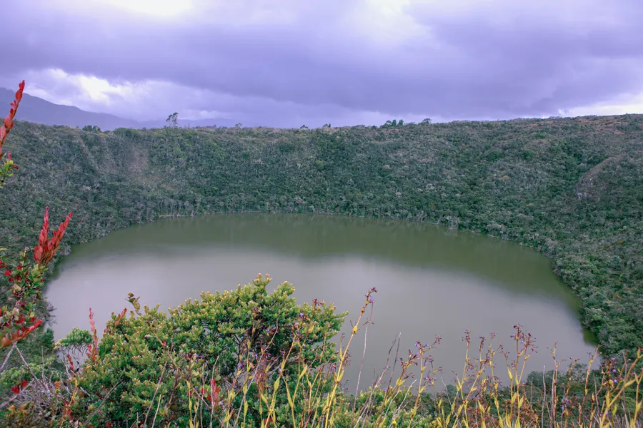
The ultimate reward is a walk on the crest of the circular lake with special views from a few viewing points. The Lake looks like a volcanic crater, but it is not. It is now believed that the lake was the result of the dissolution of underground salt deposits from an anticline resulting in a sort of sinkhole.
Photo Opportunities at the Top
You will have some interesting photo opportunities at the top. Tip to photographers: To get the whole lake into the frame, you will have to carry a wide-angle lens. The alternative would be to do what I did. Even though I carried a 24-70mm zoom lens, I could not get the whole view into a single frame at 24 mm. I had to take several shots and then combine them in Adobe Lightroom into one single image.
Once you have finished with the views, you hike down a gentle downward slope, to find your transport. The tour will take up most of your morning or the better part of a day depending on when you start and how long you spend climbing to the crest of the lake. You will then be free to drive to Guatavita town (if you plan to do both lakes on the same day).
The Picturesque Guatavita Town
Once upon a time, in Colombia’s Department of Cundinamarca, on the Altiplano Cundiboyacense, there was a town called Guatavita. It was founded on 18 March 1593 by Miguel de Ibarra.
The Creation of the Tominé Reservoir
In the late 1950s and 60s, the Colombian authorities began to draw up plans for a large reservoir in Guatavita. The Embalse de Tominé was completed in 1967 and the valley was slowly flooded. Today, the lake is 11 miles long and 2.5 miles wide at its widest. It reaches a maximum depth of 125 feet. The lake powers some hydroelectric plants and supplies the Capital City of Bogotá with drinking water. It is the biggest reservoir on the Sabana de Bogotá.
 Guatavita - Spanish Colonial Architecture and Reservoir
Unfortunately, the old town of Guatavita is completely submerged and at the bottom of the lake! It lies at a depth of about 125 feet. When the Lake reaches lower levels during the El Niño years, it is said that the tower of the old church becomes visible. Do not be disappointed if you do not see the tower: it means the reservoir has plenty of water and will give you some excellent photographs by the lakeside. I have been to Guatavita several times over the years, but have never seen the tower.
The New Town of Guatavita
As the reservoir was being constructed, the new town of Guatavita was rebuilt much above the lake level. People of the old town were rehabilitated in New Guatavita. The architecture of the new town is Colonial Spanish and there are many interesting streets and buildings. There are plenty of photo opportunities in the Town.
The town is located 47 miles northeast of the capital city of Bogotá at 8,790 feet above mean sea level on the Eastern Range of the Andes Mountains. The population of the Municipality and Town is 6,898 (2015 Census).
What to see in Guatavita
What is most interesting about the town is that even though it was constructed only about 70-odd years ago, it was designed in the style of Spanish Colonial Architecture. Everywhere you go in New Guatavita or the centre of the Town, you see walls that are made to look like old colonial Adobe, painted white. All the buildings have red terracotta tiles.
The Town Squares
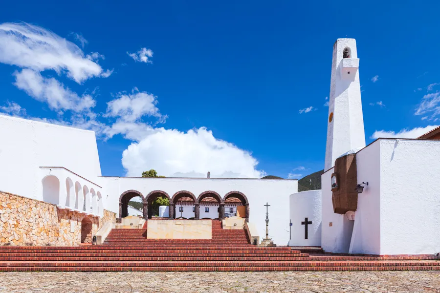 The Entrance to the Principal Town Square
Usually in Colonial Spanish towns, you will have on the main town square, the Church, a bank (or two), the school, a police station and a few restaurants. The centre of Guatavita has three main squares. One of the main squares has the church, the parsonage, an auditorium, a small museum (when I last visited, it was not worth the time I spent inside), and a couple of restaurants.
To the South of that, is another main square with a hotel, a few restaurants and souvenir shops. Further south is a square that has a large parking lot in the middle. It also has the main police station and a few other facilities on the square.
It may be a good idea to grab a quick lunch at one of the restaurants. If you have a packed lunch or sandwiches with you, you could eat it by the lakeside and enjoy the views while you eat.
The Bullring
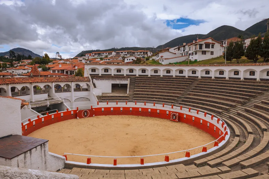 A View of the Small Bullring
Walking across the road in a south-westerly direction will take you to the town’s small bullring. It is not used for bullfighting but is these days, often the venue for small exhibitions and events. I would recommend that you walk around the town and explore the small town.
Down to the Tominé Reservoir
Downhill through the gateway in the corner in a westerly direction, will take you to the lakeside. I would not recommend walking the distance. Walking back uphill can be quite a task. Sometimes, especially on holidays, there is transportation that is free for everyone to use. The vehicle is pulled by a tractor. If you have hired a car for your trip, I would recommend driving downhill. Down at the lakeside, you have some beautiful vistas for the camera.
A Different Panoramic Viewpoint
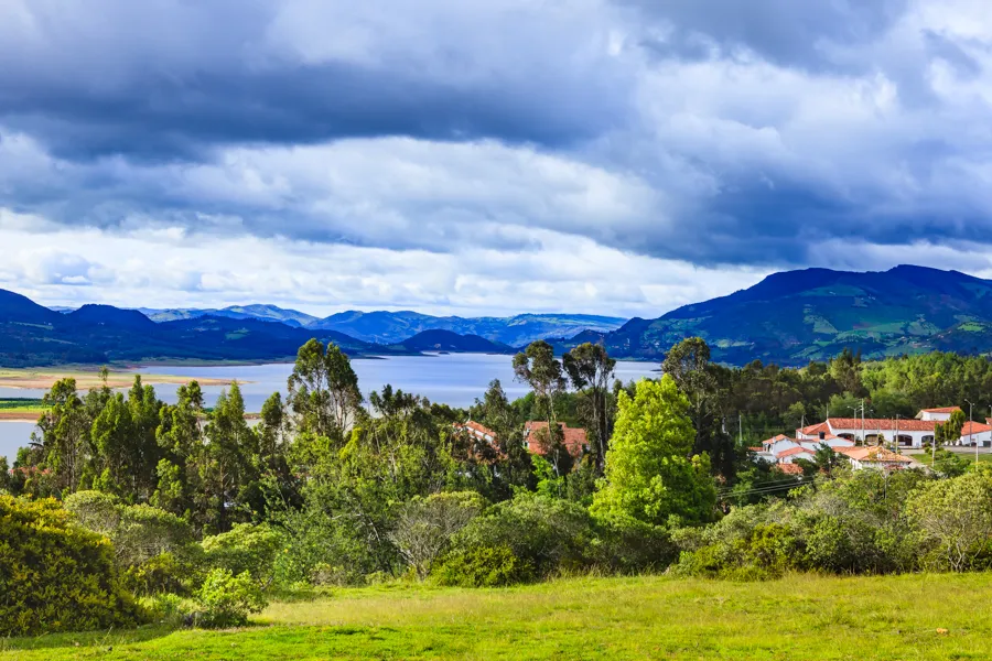 Guatavita - A View of the Embalse del Tominé
Another viewing point (not very well known), that I like to go to, is the view from a higher elevation. If you take Carrera 3 in the southern direction and turn right at the crossroads, it will lead to an unfinished road from the end of which you can have a good view of the lake and look at the whole of Central Guatavita from a vantage point.
Return to Bogotá via La Calera
For the return trip, I would recommend the route back via La Calera. Just before the town of La Calera, are some excellent views of Usaquén in the North of the Capital City. Police have these days, closed off the points where we could stop to see the views and grab some very interesting photos during the Golden Hour.
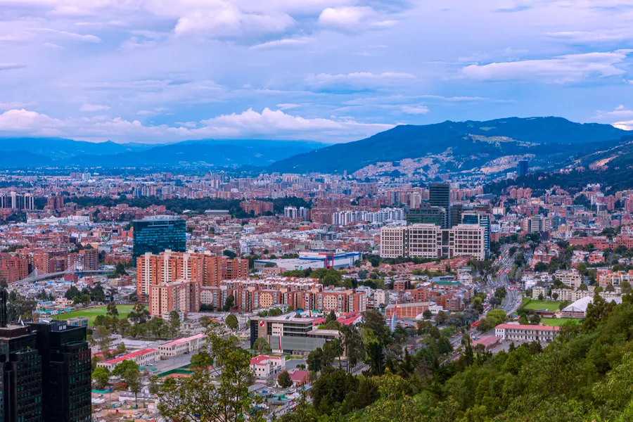 Bogotá, Colombia - A View From La Calera
There however are a few restaurants from where the sights are visible as well. You will either need to research viewpoints that could be interesting or, be on the lookout for those restaurants and hotels as you drive by. Your driver may know a restaurant or two that may have good views of Usaquén.
Additional Links and Information
- Visiting photographer in the Sabana de Bogotá; safety and security - by Mano Chandra Dhas
- Read more about the interesting story of the Embalse de Tominé (in Spanish). Source: Wikipedia
- More information on The Laguna Guatavita. Source: Wikipedia
- The high plateau - the Altiplano Cundiboyacense. Source: Wikipedia
- The Sabana de Bogotá. Source: Wikipedia
- The Muisca People. Source: Wikipedia
- Some information about Muisca Rulers. Source: Wikipedia.
All photographs in this article are by Mano Chandra Dhas.

Written by
Mano Chandra Dhas ›Founder of Coromandel Tours. In travel since 1975, from Singapore Airlines to Emirates and Carlson Wagonlit, he now curates private journeys through Colombia, Peru, India, and Nepal from his home in Bogotá. Many of the photographs on this site are his.